
The agreement with the satellite program providers is extended until January 23, 2025. This extension ensures that users will not lose access to satellite monitoring of tropical forests before a more long-term solution is in place.
Since 2020, Norway’s International Climate and Forest Initiative (NICFI) has offered users worldwide free access to high-resolution and analysis-ready images of the world’s tropical regions. The images are provided by Kongsberg Satellite Services (KSAT) and partners Airbus and Planet.
NICFI announced earlier this year a public tender for a new contract on satellite data for four years with the possibility of two extensions of one year. The process of entering a new long-term agreement is proceeding as planned and will not be affected by this extension.
Tool to combat deforestation
Since the program’s launch, tens of thousands of users around the world have utilized free, high-resolution images of the tropics. Feedback from governments, civil society, the private sector, academia, and other users shows that access to updated high-resolution satellite data is crucial for understanding and responding to tropical deforestation.
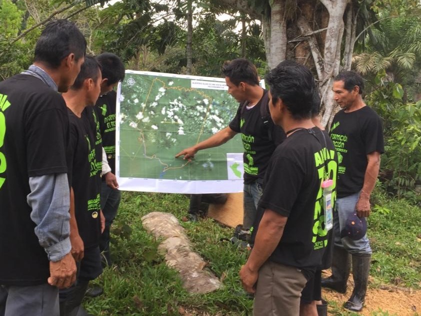
Access to data from the satellite data program is used by:
- Large rainforest countries to discover, document and respond to deforestation. The data is key to more accurately measure and report impacts of policies and improve measures over time.
- Indigenous groups in the Amazon use the maps to uncover deforestation, its causes, the actors behind it, and to alert authorities.
- Private sector use the data in their effort to ensure deforestation free supply chains
- Media has used the data for investigative journalism on environmental crime in the Congo basin, South East Asia and the Amazon.
- Civil society use the data to hold governments and private sector accountable for example monitoring supply chains of products associated with deforestation risk.
- Researchers around the world. More than hundred peer review articles have been published based on data from the program